LETEL LiDAR and GIS Mapping Services for Construction and Landscaping Precision

If you are looking for indoor digital mapping services or surveying for landscapes or construction projects, then LETEL lidar services is the best. The company provides ingenious solutions using the latest technologies, such as LiDAR and GIS mapping, in many industries.

LETEL company uses LiDAR, GPS, and building schematics in creating interactive indoor digital mapping, providing full details covering layouts to emergency assets. Besides offering LETEL services in construction, surveying, and indoor mapping, the company also expands to many industries with innovative, cost-effective solutions. Let’s have a close look at their creative services in construction and landscaping.

To gain more insights about LETER services, check out https://www.instagram.com/p/DBcv4d5sWYf/?igsh=MXFkNG1oa2w2ZHcxcA==.

LETEL in construction

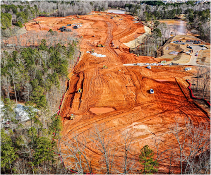
LETEL is offering innovative high-technology services to meet the demanding construction needs. In the modern construction industry, precision is the most essential thing that sets you apart from your competitors in the construction business. LETEL understands and takes care of every small detail in enhancing your construction project.


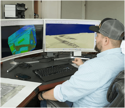
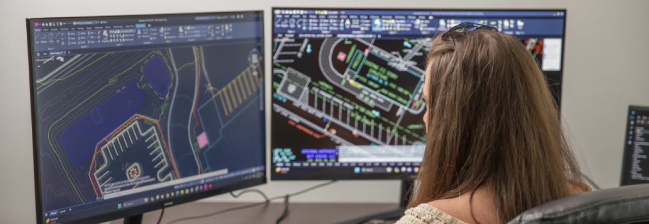
For example, LETEL’s no-nonsense approach facilitates accurate surveying and clear-cut data. LETEL has highly skilled professionals who are well-versed in handling tech tools to execute the planned project accurately.

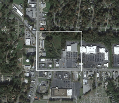
Those high-tech digital terrain modeling services provided by LETEL in surveying include LiDAR mapping and Aerial inspection.

  • With LETEL’s advanced techniques, it is easier to finish the construction project quickly. From the concept plan to full work completion, without any delays impacting the budget.
  • With the latest precise surveying, mapping, and data, it is easier for engineers to design and process without any compliance issues.
  • Finally, LETEL lays the foundation from planning to building it with the proper regulations.

LETEL in Landscaping

Not only in construction, LETEL excels in its services in landscaping.

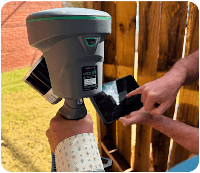
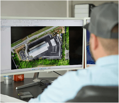
With advanced LiDAR services, LETEL brings out an excellent level of precision in unveiling landscapes. Even in challenging terrains, LETEL’s high precision data capture technology achieves impressive accuracy, often within 1-3cm. And its latest aerial mapping technology helps in optimizing resource allocation.


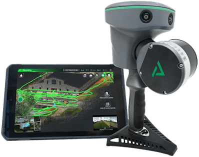
LETEL high technology scanners can capture even complex landscapes precisely

Some places are challenging to fly drones, even in ideal conditions. LETEL’s new advancement, planimetric mapping, TrueView GO 116S, a handheld scanner, captures highly accurate 3D data. So, for places with airspace restrictions and harsh environments.

To know more details, visit https://letelmetrics.com/.

Contact: (404) 518-6985

Original Source: http://bit.ly/4mDtRMN

Cut Costs and Improve Accuracy with Professional LiDAR Mapping Services

LiDAR mapping is reshaping the definition of analyzing and collecting geospatial data. Helping businesses cut down on costs through effective investments and delayed work processes.

The gathered LiDAR data is imported into GIS (geographic information systems) to prepare the detailed maps. These LiDAR mapping data aid in studying and analyzing the terrain, enabling faster decision-making on projects. In this article, let’s discuss even more information on how helpful LiDAR mapping services are across industries.

LiDAR uses remote sensing technology to measure the distances to the Earth’s surface. With the help of drones, LiDAR systems perform precise scanning of the Earth’s terrain and give accurate 3D models and data.To gain more insights, check out https://youtu.be/A2tOmfPnJco?si=KPkCnA2roW8Nw6bw.

Aerial mapping brings a great deal of advantage to traditional surveying 

  • Besides saving time and labor power, it also covers large surface areas for mapping in just a fraction of the time.
  • Top-notch precision.
  • Aerial mapping can map even in rough climatic conditions and environments, and
  • The handling of mapping equipment is entirely safe for use by the surveyors.

Many industries are using aerial mapping because of its precision and fast results.


LiDAR mapping is a cost-effective

This innovative technology is a boon for many industries, including construction, mining, and urban homes.

  • No project delays: With LiDAR mapping, data collection is now possible in just a few hours, significantly reducing the time required for ground-based surveys, which can take weeks to months.
  • No scope for human errors: No scope for mistakes because with the help of LiDAR, it is possible to take measurements with the highest level of accuracy.

Finally, if you are someone working on large surface areas and uneven terrains, make use of LiDAR mapping technology. It is helpful in any field, whether you are looking to build pavements, manage large acres of land, or construct urban areas.

What are Digital Terrain Models?

Digital terrain models are the geographical models of the bare Earth that are manipulated by computer programs. With the help of DTM, civil engineers and surveyors can remove buildings, trees, and other structures from the Earth, focusing solely on the ground surface. So finally, DTM, also known as a digital elevation model, helps with the 3d representation of terrain elevation stored in the grid format.


About LETEL:

LETEL is a LiDAR company that is providing cutting-edge professional-grade LiDAR services in landscape analysis. The company also helps in creating superior quality digital terrain models, reducing risks in construction.

To know more details, visit https://letelmetrics.com/.

Contact: (404)518-6985

Original Source: http://bit.ly/3HX8FCh

Comprehensive Terrain Analysis Using GIS Mapping and Inspections

Terrains might be a part of nature’s marvelous creations. But they hide many secrets and intricacies. The problem arises with the terrain’s nature, characteristics, and components. Constructions become more complex on these terrains. However, GIS mapping Georgia and inspections bring ease to the process. These two procedures are a vital part of planning and design.

Check out this Facebook post https://www.facebook.com/watch/?v=1284270199770325 now.

The Purpose of GIS Mapping and Inspection:

Planning and design are impossible without data. However, accumulating data for these procedures is a challenge in itself. Approaching these locations manually involves risks.

In such cases, contractors and engineers can rely on procedures, like GIS mapping and inspection. This subtle concept gives enough data about a location to support every part of strategizing.

The Use of Advanced Technology:

Aerial images are crucial to understand the structure and build of the terrain. But what lies within can be more critical. A terrain’s composition should be studied before it is approached. Walking on weak grounds can lead to consequences. Therefore, manual procedures should be controlled until researchers have enough data.

Using digital terrain models, contractors and engineers can gain an idea of the build. The terrain’s shape, size, and composition can be determined using efficient technology. It is like having a clear image of the space without even stepping on it. So, try these mapping and inspection solutions for efficient results.

Topographic Features:

You need a clear idea of the surface that you will be working on. In professional terms, terrain’s topographic features should be determined beforehand for suitable planning and execution. However, the process may seem impossible without digging and excavation.

In such cases, engineers and other experts can rely on professional GIS mapping and GIS inspection services. These professional services help discover the details. These studies can support the decision of conducting the project on a surface or to let it pass. Therefore, considering these services is better for efficient planning.

The Key Point:

GIS mapping and inspection services bring intelligence into the process. Technology and science are combined appropriately to support planning, strategizing, design, and implementation. With these supportive data pieces, engineers and contractors can complete the project and deliver solutions as expected.

LETEL is a prominent name in the market. The service offers incredible solutions. You can get more details at https://letelmetrics.com/

Contact: (404) 518-6985

Original Source: http://bit.ly/4lTsJDH