LETEL: Map It Right with the Best Planimetric Mapping Services

In a world where precision comes with innovation, LETEL leads the herd with its cutting-edge mapping services. It unlocks the full potential of a land. Furthermore, you need more than a map when a project demands detailing, and time is money. It is where LETEL brings vision-forward, expert planimetric mapping services.

What is planimetric mapping? Why does it matter?

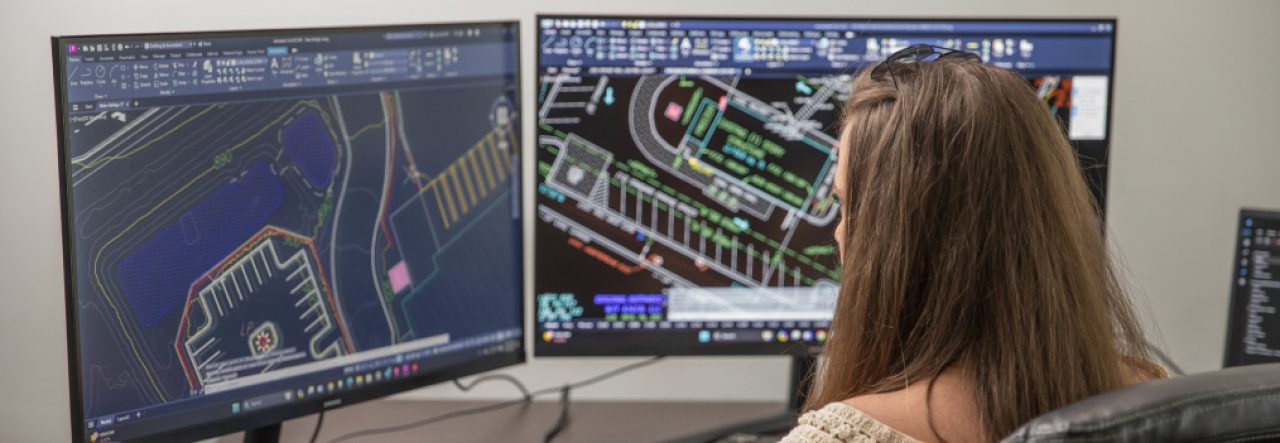
Planimetric maps are not your ordinary visuals. They are an intelligent blueprint of the real world. Furthermore, they focus on roads, curbs, utility lines, buildings, and sidewalks. In summary, it focuses on features that lie above the surface, minus the topography. For developers and architects, it offers a clear canvas to build their next big idea.

LETEL provides advanced mapping solutions for accuracy, detailing, and clarity to build efficiently without costly surprises.

Why is LETEL’s mapping a game changer?

High precision, you can count on

LETEL provides industry-leading software and aerial data-capturing techniques, such as drone imagery and LiDAR mapping services. Furthermore, it delivers highly accurate visual data of every curb, corner, and contour.

Custom solutions for every sector

LETEL’s mapping services are customized for your industry and objectives. It has mastered mapping solutions for city infrastructure upgrades, energy installations, utility management, and residential development. The team works closely to help define your scope, align needs, and deliver actionable insights.

Reduced risk and increased workflow

Accurate planning helps reduce delays, enhances budgeting, and creates a safer workplace. LETEL’s mapping services discard the guesswork for your team to focus on the goal with confidence and speed.

A visual edge moving the project forward

LETEL delivers maps after understanding your vision and end goal. It has digital planimetric files compatible with most engineering and CAD software. You can drop these into your workflow with no friction. Get the data at your fingertips for zoning a new division or renovating an old facility.

Map out your success with LETEL

At LETEL, mapping is a tool for making innovative decisions, safe buildings, and attaining successful outcomes. The company has extensive experience, state-of-the-art equipment, and a passionate team to provide precise solutions.

LETEL helps you see the bigger picture in the smallest details with its digital terrain modeling. LETEL guides you to move your project from concept to construction with its distinctive mapping services.

To get more details, visit https://letelmetrics.com/

Original Source: https://bit.ly/430BXqm

Understanding GIS Inspection and Its Impact on Modern Infrastructure

Imagine this: you are walking on a street and see some people flying drones and performing analyses of a particular area. You start wondering, what is happening there? You approached one man and asked about the same. It was a GIS inspection going on, as told by the man. It is the most advanced way to digitally map an area. It helps inspect and manage the asset efficiently and accurately. So, without much delay, let’s start exploring it in more detail!

What is GIS Inspection?

GIS (Geographic Information System) is a process that uses GIS tools and software to inspect and monitor the physical assets of an area. It involves capturing, analyzing, and updating asset data in real time. It is often carried out by drones and sensors.

Why Does GIS Inspection Matter?

Here are some of the reasons that make the GIS Inspection system important:

• Provide location-based insights in an accurate manner, which helps in mapping the assets digitally.

• Uploading the inspection data by the field workers is now performed in just a few clicks.

• Fast inspections are performed along with quick report generation

• Cost-effective way of inspecting a geographical location.

• Reduce the need for paperwork and manual labor.

What are the Key Applications of GIS Inspection?

Road and Bridge Inspection – To inspect and collect essential data regarding the geographical location, it can now be performed easily with GIS Mapping Georgia.

Environment Monitoring – GIS inspection is vital for protecting natural resources. It allows for easy monitoring of challenging terrains. With GIS, you can observe forests, lakes, and wildlife and track changes in these environments over time.

Property Inspections- GIS Inspectionaids in managing and monitoring various facilities such as schools, parks, and industrial zones. It allows you to track building safety, faults, waste disposal, inspecting light systems, etc.

After understanding the meaning of GIS inspection and its importance, you must understand the importance of GIS-based data collection, which supports accurate decision-making for various industries and organizations.

Choose a leading company in Georgia that provides GIS inspection using drone technology, digital terrain models service, and GIS mapping. It should serve various markets, including construction, commercial, energy, and government.

If you are also feeling the need to inspect with precision and perfection. Feel free to contact them!

For more details, visit LETEL at https://letelmetrics.com/

Original Source: https://bit.ly/42Xzz3w

Top 5 Reasons to Choose Lidar Services for Accurate Mapping

Lidar, short for “Light Detection and Ranging,” is a smart technology that is becoming more popular in many areas like studying forests, self-driving cars, mapping land and even exploring ancient sites. It works by sending out laser beams and measuring how long it takes for the light to bounce back after hitting something. Lidar services also help to create detailed 3D maps, known as point clouds. Let’s explore the advantages of Lidar.

Speed

Lidar is known for its high-speed working. It includes a sensor that sends out laser beams and gets them back in just a few nanoseconds, which helps it scan huge areas quickly and still collect data.

Accuracy

One of the main benefits of using lidar services is its accuracy. It delivers fast and accurate results in a shorter time than others. The short light waves can spot even small objects and build accurate 3D models. It helps tell what the object is like a tree, person, or wall. If you are also planning to opt for such technology, choose them from a trusted lidar company for the best results.

Functionality

A lidar service from a reputable brand offers functionality and consists of automated processes. Unlike traditional methods that require more involvement in hands-on practices, lidar technologies give efficient and proven outcomes.

Cost-Effective

Lidar is comparatively less expensive than other methods. It is a low-cost way to create detailed maps of the land. If you want the same for your businesses, look nowhere other than a reputable lidar company! It provides the best and most affordable range of services that anyone can choose easily.

Multisource

Lidar services can also collect data from multiple locations. Places that are hard to reach like dense forests, mountains, and others, are covered through lidar technology. The system can capture all the necessary data and make collections of them based on the situation.

About LETEL:

LETEL is a popular firm in the region that offers various services including drones, LidAR, digital terrain models, civil engineering and more. It has the best team of experts who have specialization in the field. Opt for their services and get the most favourable results! Order them today and obtain the most amazing services!

For more information, check out this https://letelmetrics.com/

Original Source: https://bit.ly/3GEenYU

What You Can Do with LETEL’s Digital Terrain Modeling

Construction sites have to face many challenges while working on unpredictable terrain. There are miscalculations, increased costs, and material wastage, all due to a lack of planning and organization. The fault lies in traditional survey methods. These methods fail to capture precise data. It leads to numerous errors, with long-term negative results like unstable foundations, rework, and inefficient workflows. LETEL brings a modern digital terrain models that can help you in many ways. Let’s understand how you can take advantage of its services.

Precision at Every Stage

LETEL’s digital terrain modeling can capture elevation changes with great accuracy. This means that your project gets highly accurate site planning. The experts use advanced drone technology, GPS-based data collection, and modeling systems that create detailed 3D models. These models provide depth so that you can plan accurately for these construction projects.

Smarter Earthwork Calculations

Calculations should be top-notch if you want to plan a construction project with different elements. LETEL’s accurate calculation model prevents miscalculations in material movement and excavation. It provides exact estimates about how much soil is needed to be removed or added. Its digital terrain modeling can also reduce wastage and inefficiencies with machine control integration that ensures precision in execution.

Improving workflows for faster completion

LETEL’s modeling is not just detailed; it also does everything at a fast pace. You can expect improved construction timelines with its modeling that eliminates unexpected terrain issues and provides proactive planning. The contractors can analyze the challenges before they start working. They can make simple strategies with real-time terrain data that reduce delays.

Aerial Mapping for Unmatched Site Analysis

High-resolution aerial scans can provide accurate topographical data that other survey methods can miss. LETEL’s drone technology is updated regularly, which means that progress and changes are shown in real-time.

Innovation that Drives Better Outcomes

LETEL integrates the best software with terrain modeling to offer simulations, predictive analytics, and topographical studies. Its planimetric mapping helps predict drainage patterns, structural stability, and land usage to reduce risks and improve efficiency.

No More Guesswork

One of the biggest pluses of LETEL’s services is that it allows data-driven construction that leads to less guesswork in modeling. It eliminates big errors in construction projects. Every phase of the construction becomes more efficient, and any unnecessary loss is avoided. It saves time, and it saves money in construction.

If you want to take advantage of LETEL’s digital modeling services, get in touch today by visiting https://letelmetrics.com/

Original Source: https://bit.ly/3F0o1Eg

Everything You Should Know About Digital Terrain Models

Digital terrain models are primarily a digital representation of a surface or terrain in any location. With its help, one can find a 3D model that helps with understanding the elevation, slope, and various features of the surface. One can rely on LiDAR services for creating a digital terrain model. Digital terrain models are created with the help of digital elevation models. These models can be generated with LiDAR.

Understanding how digital terrain models can be used:

  • Topographic mapping:

Digital terrain models help with creating maps of the surface area. When you gain access to these maps, you can rely on them for different purposes, such as environmental assessment, natural resource management, and more.

  • Engineering design:

Digital terrain models can also be used for different types of construction projects. So, whether you are planning on constructing a highway, a building, or just pipelines, you can choose these solutions. It will help you gain insights into the terrain. One can also use technology to design infrastructure like drainage systems.

  • Hazard assessment:

Different natural disasters like floods or landslides affect people and can be a huge threat to the environment. Digital terrain models also help with assessing these hazards on time. Therefore, you can work on creating the right strategies to ensure the loss is reduced as much as possible.

Perfect for different industries:

Digital terrain models are suitable for a wide array of industries such as surveying, engineering, environmental management, and more. Therefore, if you are working in these industries, you can get the solutions to ensure fewer risks in your project. With digital terrain models, you can also improve the overall accuracy of your projects.

Improving project planning:

Digital terrain models help individuals from various industries plan projects with utmost efficiency. When these individuals get access to in-depth information about the terrain or area, they can analyze the site and make the required calculations to avoid any unexpected delays in the project. All projects will be completed seamlessly.

Improving your workflow:

When professionals start working on a project without prior preparation, it can affect the workflow and the project may be completed in more time than anticipated. With solutions like digital terrain modeling, one can complete projects without complications.

If you need assistance with grove landing, choose a trusted and reliable option.

To get more details, visit https://letelmetrics.com/

Original Source: https://bit.ly/43mYkrx

Revolutionary Technology: Fostering Creativity Across Industries

Technology has been a revolutionary introduction in almost every industry. Whether your business deals with virtual aspects or general ones, technology will always be a superior component everywhere. One of the most compelling parts is the use of technology in construction, inspection, and similar fields. For instance, GIS inspection has been a groundbreaking addition to the process.

Here are some prevalently utilized technologies and practices.

GIS Inspection:

Inspection orients a project correctly. Working on terrains, designing a project, streamlining procedures, etc., will be easier with inspection. However, inspecting larger pieces of land can be daunting.

GIS inspection will be an incredible addition to the method. It allows contractors and other project managers to unlock geo-intelligence. It can troubleshoot probable errors in the beginning. GIS inspection enhances assessment proficiencies. Hence, it is an excellent solution for all.

Planimetric Survey:

Most people consider planning to be the first and foremost step of any process. Well, it’s not! There’s more that contractors and project managers need before they can design a plan. They need exclusive insights and details that can be decisive till the end.

Planimetric survey might be the first step in these situations. It is crucial to inspect and assess the surface before any conclusion. Even a plan’s feasibility depends on survey discoveries. For instance, it is convenient to determine whether land is ideal for the project or not. The planimetric survey is a crucial step here.

LiDAR Mapping:

Light detection and ranging, widely known as LiDAR, is an absolute technology used for 3D mapping the Earth’s surface. It used laser technology to determine the differences in surfaces. LiDAR mapping contributes exceptionally well during different projects. Highway construction, laying railway tracks, mining, excavation, etc., are some tasks that rely on LiDAR mapping.

The introduction of LiDAR has enhanced precision and planning. The data captured and accumulated using this technology has proved its worth in construction and other fields. It can also help with resource allocation and management throughout the project.

About LETEL:

LETEL offers complete technological aid to its clients. Whether you are about to begin construction, mining, or excavation projects. GIS inspections, planimetric survey, and LiDAR mapping are among the many offered services. LETEL makes sure that you have enough data and resources to plan efficiently.

Check more details at https://letelmetrics.com/

Original Source: https://bit.ly/3XsXVQB